Hobärggletscher
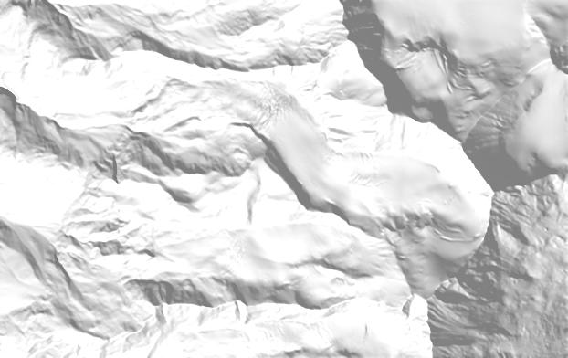
Past extents come from the Swiss Glacier Inventories of 1850, 1931, 1973 and 2016. Future extents are illustrative: each glacier’s projected area (OGGM, median of CMIP6 climate models) is removed from its lowest ice upward. About the scenarios.
Hobärggletscher is the 59th-largest glacier in Switzerland, covering 2.98 km² in the canton of Valais. Its ice spans 2,801 to 4,544 m and faces north-west. Its meltwater drains to the Rhône and on to the Mediterranean. In 1850 it was part of a larger ice body of 3.8 km², which has since split into 2 glaciers covering 3.2 km² in 2016 (−15%). Between 1977 and 2015 its surface dropped by 2 m on average. With strong climate protection (SSP1-2.6), about 54% of its 2020 ice would remain in 2100. With very high emissions (SSP5-8.5) it would be gone around 2088. Its meltwater peaked around 2020.
What remains in 2100
Meltwater
Million m³ of water per year, 11-year mean
Facts
Area over time
Past areas are the ice body this glacier belonged to at the time. Projections: OGGM median, SSP2-4.5.
- SGI id
- B55-04
- Canton
- Valais
- River
- Rhône → Mediterranean
- Basin
- Vispa
- Location
- 46.1070° N, 7.8480° E · swisstopo map
- Elevation
- 2,801–4,544 m, median 3,665 m
- Slope, aspect
- 24°, north-west
- Debris cover
- 0.07 km² (3% of the area)
- Inventory image
- 2015
- Ice volume (model)
- ≈ 0.172 km³ in 2020 (OGGM)
- RGI ids
- RGI60-11.02569
- In 1850 joined with
- Hobärghorn W
More in the Vispa basin
- Gornergletscher41.23 km²
- Zmuttgletscher14.82 km²
- Findelgletscher13.86 km²
- Feegletscher zentral13.82 km²
- Unterer Theodulgletscher9.63 km²
- Allalingletscher9.09 km²
- Riedgletscher7.23 km²
- Schwarzberggletscher zentral5.14 km²
- Hohlichtgletscher4.54 km²
- Bisgletscher4.18 km²
- Furgggletscher3.82 km²
- Mellichgletscher N3.08 km²
Sources
- Linsbauer et al. (2021). The new Swiss Glacier Inventory SGI2016. Frontiers in Earth Science 9. doi.org/10.3389/feart.2021.704189
- Mannerfelt et al. (2022). Halving of Swiss glacier volume since 1931 observed from terrestrial image photogrammetry. The Cryosphere 16. doi.org/10.5194/tc-16-3249-2022
- GLAMOS – Glacier Monitoring Switzerland. www.glamos.ch
- Zekollari et al. (2024). Twenty-first century global glacier evolution under CMIP6 scenarios and the role of glacier-specific observations. The Cryosphere 18 (OGGM v1.6 projections). tc.copernicus.org/articles/18/5045/2024/
Relief: swisstopo swissALTIRegio. 1850 and 1973 outlines: Maisch et al. (2000), Müller et al. (1976), Paul (2004). Length, mass balance and volume change: GLAMOS releases 2025. All sources and methods.